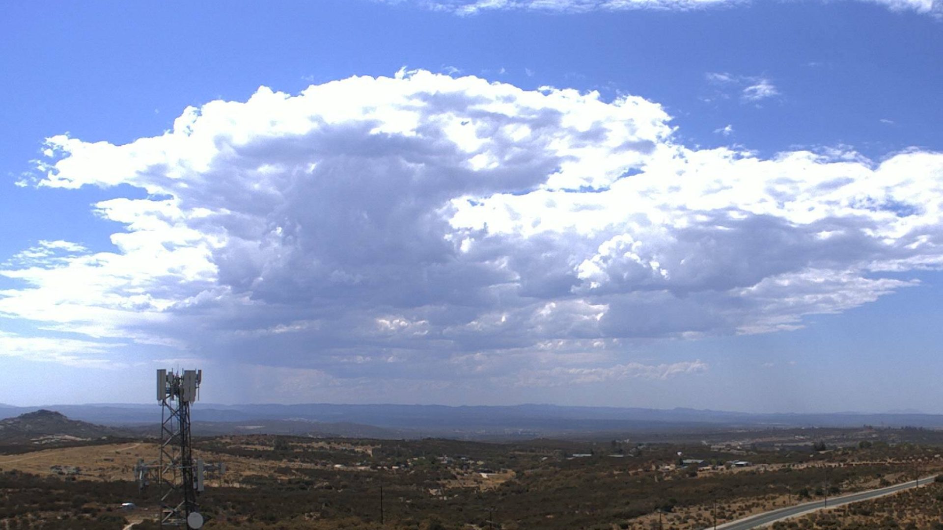
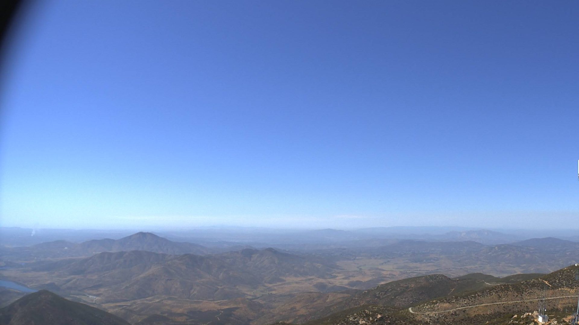
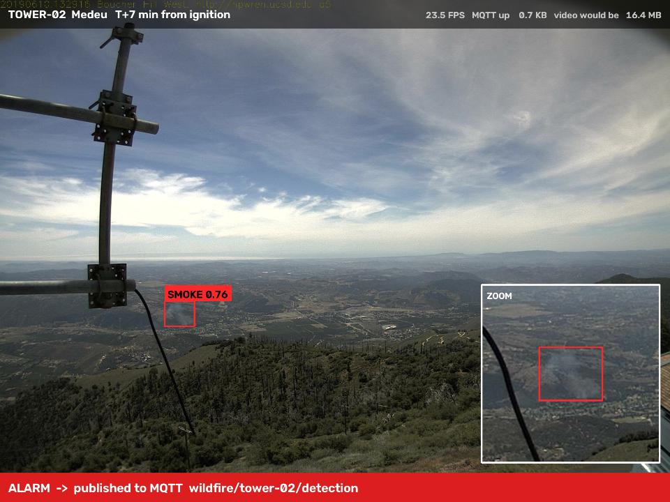
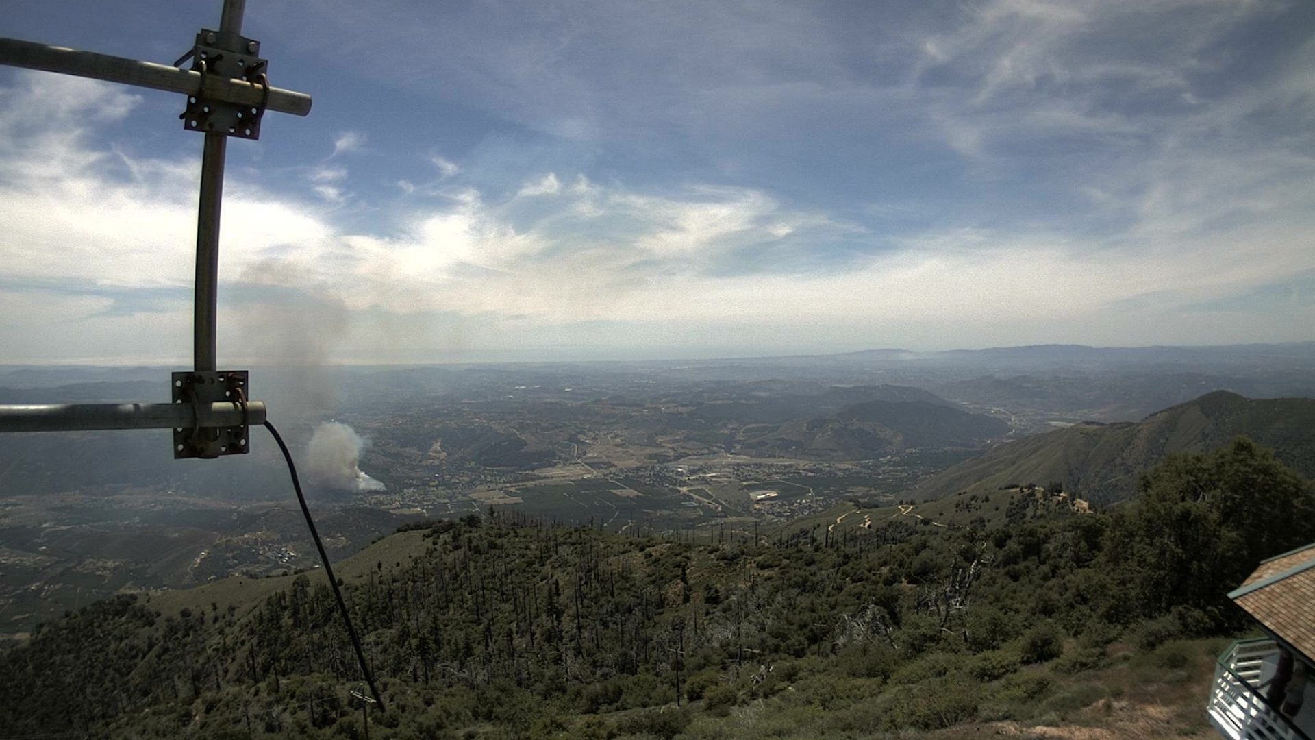
Smoke plume seen from an HPWREN tower camera
Internet of Things & Big Data
Early Wildfire
Detection
Edge AI on an IoT camera network

Kanatbay Alibek · Shaykhmetov Alimzhan

KBTU · 2026

Smoke column rising behind a communications tower
The problem
Minutes matter

Satellite products such as NASA FIRMS report hotspots hours after a fire starts. A camera on a tower sees the smoke column almost at once.

Hours

satellite hotspot reports, depending on overpass and processing

6min

median time from ignition to alarm on our eight test fires

Goal

Recognise smoke in tower camera video, estimate where it is, and alert an operator with as few false alarms as possible.

Wildfire IoT02 / 10
IoT system
Architecture
LIVErunning in today's demo NEXTplanned

Camera

Fixed PTZ camera on a fire tower

NEXT
frames

Edge node

Raspberry Pi 5 or Jetson Orin Nano: YOLO smoke detector, 3-frame filter, bearing

LIVE · on laptop
MQTT · LTE

Server

MQTT broker, Python backend, triangulation

LIVE

TimescaleDB + PostGIS, MinIO, Grafana

NEXT
WebSocket

Operator

Live map console and Telegram alerts

LIVE

Weather

Temperature, humidity, wind on the same tower

LIVE · simulated
NB-IoT
Wildfire IoT03 / 10
Edge first
Events, not video
233×

less uplink traffic: towers analyse frames on site and send only small events.

Video stream, 2 towers × 81 min48.4 MB
MQTT events, same period212.7 KB
MQTT topics
wildfire/
<tower>/statusRetained, Last Will “offline”20 B
<tower>/heartbeatEvery 3 s: FPS, uplink111 B
<tower>/detectionQoS 1: bearing, JPEG70–90 KB
<tower>/weatherNB-IoT, short keys58 B
server/fireRetained fire position155 B
Wildfire IoT04 / 10
Computer vision
Data and model

FIgLib

525

fire sequences from HPWREN tower cameras, one frame per minute, 40 minutes before and after ignition

Test set today

Pyronear

YOLO11s

tower imagery and an open smoke detector, Apache-2.0, trained for early smoke

Baseline today

D-Fire

20k+

labelled smoke and flame images in YOLO format

Our training · next

NASA FIRMS

Years

of satellite hotspots for Kazakhstan, clustered with DBSCAN into a fire-risk map

Risk map · next
1024 pxinput size
19–29 msper frame on a laptop GPU
≥ 0.20confidence per frame
3 framesin a row before an alarm
Wildfire IoT05 / 10
Results
Detection on real fires
FireFirst hitAlarmFalse before
2019 · bh-w+3+70
2019 · lp-s+5+70
2020 · om-n+5+70
2020 · rm-w–missed0
2020 · pi-s+4+60
2021 · wc-e+0+50
2023 · pi-s+0+60
2024 · ws-s+1+31

Minutes after ignition, HPWREN FIgLib sequences.

7/8fires detected
6 minmedian to alarm
1false alarm in 313 min before ignition
Wildfire IoT06 / 10
Working demo
Live pipeline
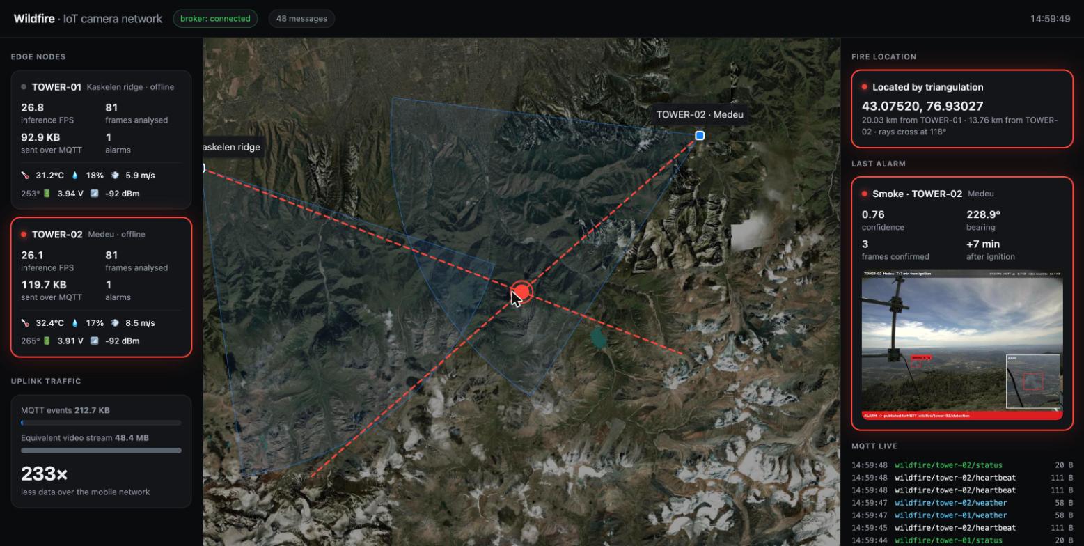
Operator console: two towers, bearing rays and the triangulated fire on a satellite map
video→edge node→MQTT→backend→map + Telegram
W
WILDFIRE
bot
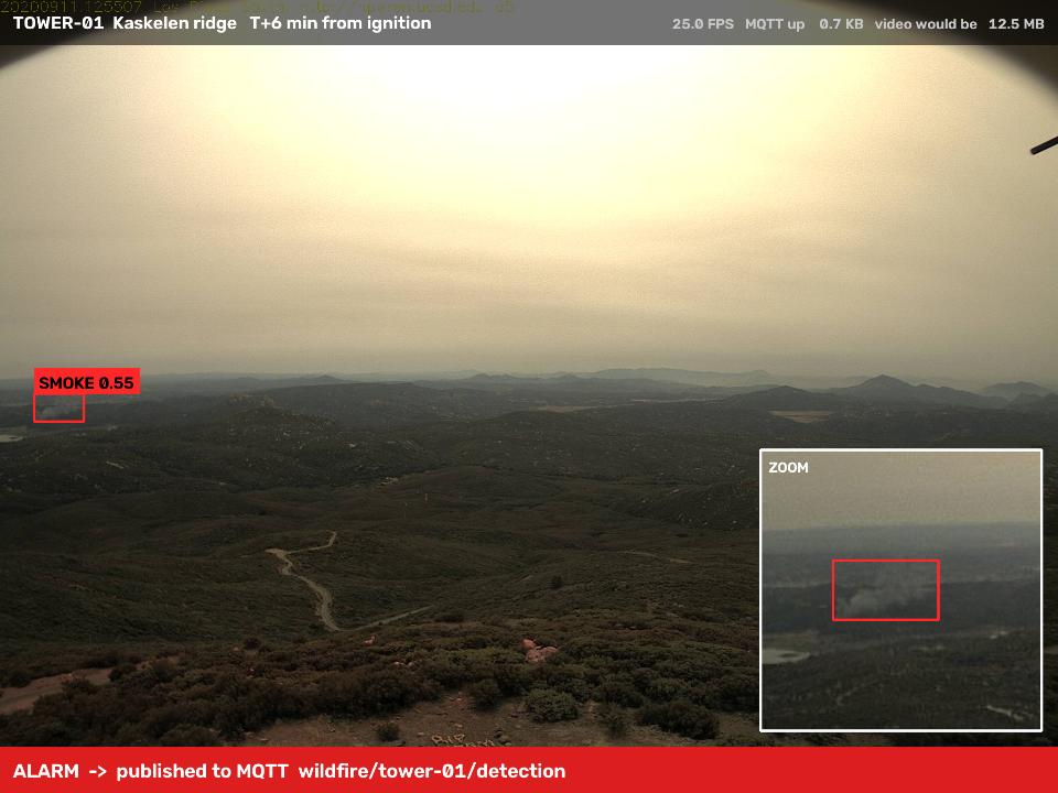
Alarm snapshot from tower 01
🔥 Smoke detected · TOWER-01
Confidence 0.55 · bearing 111.0°
14:59:31
Alarm snapshot from tower 02
🔥 Smoke detected · TOWER-02
Confidence 0.76 · bearing 228.9°
14:59:36
📍 Fire located by triangulation
43.07520, 76.93027 · 20.0 km / 13.8 km
14:59:36
Wildfire IoT07 / 10
Localisation
Locating the fire
bearing = heading + atan((x − W/2) / f)
f = (W/2) / tan(FOV/2)
1 towergives a ray. Range along it needs terrain: ray × SRTM elevation model (next)
2 towersrays cross at the fire. Today: 20.0 km and 13.8 km, crossing at 118°
Lasernot used: it reaches a few km and smoke is not a solid target

DJI Mini 4 Pro · final stage

Fly to the fix, confirm smoke from close range, and measure localisation error against the drone's GPS.

Geometry is a staged scenario: HPWREN footage replayed on two virtual towers near Almaty.

Wildfire IoT08 / 10
Interactive
Place a fire

Click anywhere on the map. Each tower decides if it can see the smoke, finds it in its frame and turns the pixel into a bearing.
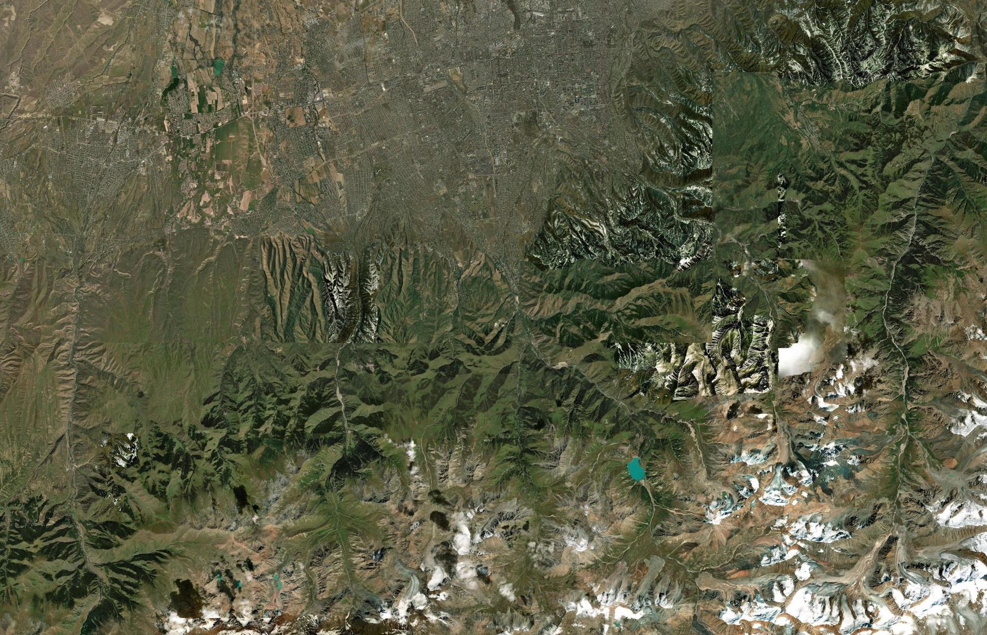
Satellite map of the Ile-Alatau foothills south of Almaty Imagery: Esri, Maxar, Earthstar Geographics
Camera
Sensor
Telegram: offline

No rangefinder. A laser reaches a few kilometres and smoke is not a solid target. Distance comes from a second tower, or from terrain (DEM) for a single tower.

Wildfire IoT09 / 10
Plan by weeks
Done and next

Weeks 1–7

  • Review and datasets
  • YOLO baseline, evaluation
  • IoT architecture, MQTT

Weeks 8–10

  • Temporal filter
  • Edge node
  • Sequence model
  • Pi / Jetson

Weeks 11–13

  • Map and alerts
  • Terrain range
  • Risk map, fuzzy
  • Drone check

Weeks 14–15

  • Experiments
  • Report, defence
Thank you
Wildfire IoT10 / 10
← → to navigate · F for full screen